
Savernake Parish History
Alone of the medieval forests of Wiltshire, Savernake conforms to our notion of what a royal hunting forest was like. Guidebooks have eulogized it: there is nothing like it in England, its magnificent expanse, with glorious old oaks and beeches, and in other districts, wild forest growth of thorn and bracken and bush, with beautiful open glades where deer wander. That was published in 1911, but despite the subsequent vicissitudes of war, tempest and the Forestry Commission, the description is still correct, and the charms of Savernake continue to attract walkers, campers, naturalists and the partakers of barbecues. What is quite incorrect, however, is our notion of modern Savernake as a medieval forest, and a few lines will be well spent in trying to trace its evolution.
The first reference to the wood which is called Safernoc occurs in a charter of 933/4 describing land nearby, but the name is thought to be of Celtic origin and so a good deal older. Its derivation may be similar to that of the River Severn, but the meaning, and the extent of the woodland during the Saxon period, are uncertain. The presence of a royal huntsman at nearby Burbage in the eleventh century suggests that by the time of the conquest the area was already fulfilling its later function, and by 1130, when the forest is first mentioned as such, this must have been formalised.

Savernake Parish in 1773
A medieval forest was a legal designation, rather like a modern national
park, which did not imply royal ownership nor an abundance of trees, but which
did impose restrictions on what landowners, farmers and inhabitants could do
within the area so designated. The restrictions were designed to encourage and
conserve animals for hunting, but created economic blight and personal hardship
for those unlucky enough to find themselves under forest jurisdiction. And by
the twelfth century the area involved was very considerable, as perambulations
of Savernake made between 1175 and 1199 define the forest as extending from
East Kennett and Pewsey in the west to Collingbourne Kingston in the south, the
River Kennet in the north and the Hampshire and Berkshire borders in the east.
Although some woodland was undoubtedly to be found in this area it is likely to
have taken the form of sporadic copses and coverts rather than continuous
tracts of what we think of as forest. To police and administer this substantial
area according to forest law a large bureaucracy of foresters, rangers,
regarders and woodwards existed under the control of a warden a hereditary
office enjoyed successively by the families of Esturmy (until 1427), Seymour
(until 1675) and Ailesbury, to the present day. The symbol of their authority
since the fourteenth century has been a magnificent hunting horn of ivory
inlaid with engraved silver bands.
From the later thirteenth century (strictly speaking from the signing of Magna
Carta in 1215) the medieval forests began a period of retrenchment and
fragmentation. In 1301 a new perambulation of Savernake was drawn, and this was
confirmed and implemented thirty years later. Some 80% of the lands were
disafforested, and what remained lay in five parcels, probably corresponding to
the most heavily wooded or least populated portions of the five bailiwicks into
which the larger forest had been divided. Three of these parcels lay detached
and at some distance from the present forest Hippenscombe, Southgrove and
Bedwyn Brail but the other two, known as the Farm (or Verme) and West
Bailiwicks, correspond roughly to the modern parish of Savernake.
Savernake, however, was not a parish in medieval times. Parts of it lay in
Preshute, Little Bedwyn and other bordering parishes, and the remainder, which
was probably very sparsely populated, was considered to be extra-parochial.
Only during the 1850s was the area parished for both civil and ecclesiastical
purposes, and not until 1934 were the two resulting civil parishes of North and
South Savernake combined to form the modern civil parish of Savernake. The
ecclesiastical boundaries are different, so that the present parish church of
Savernake, St Katharine's, lies in fact in the civil parish of Great Bedwyn (it
shared responsibility for the forest with another Victorian church, now closed
Christ Church, Cadley). Although a modern creation, however, the curiously
irregular boundary of the civil parish in fact reflects much earlier
developments, and so we must return to the middle ages.
The boundaries west of the A346 Marlborough-Burbage road correspond roughly
with those of the West Bailiwick defined by the perambulation of 1301. This
bailiwick had by 1464 been subdivided, and was controlled by three
under-foresters, responsible for Pantawick (the northern part overlooking
Marlborough), West Baily (the central part), and Iwode (the southern
excrescence which surrounds Brimslade). Had Savernake suffered the fate (or
rather enjoyed the liberation) of the other Wiltshire forests it would like
them have been disafforested and sold by the crown during the seventeenth
century. However, under the early Tudors the Seymour family, hereditary
wardens, was in the ascendant, and during the power vacuum which followed the
death of Henry VIII in 1547 Edward Seymour (who was the late king’s
brother-in-law) was created Duke of Somerset and Protector of the Realm during
Edward VI’s minority. The zenith of his power was brief and came to the
abruptest of ends in 1552 when he was executed, but in 1548 or thereabouts he
had been successful in obtaining Savernake as a gift from the crown. More
significant, his descendants managed to retain it following his disgrace.
But in private hands the forest and its deer could not be protected by royal
forest law, and so to deter would-be poachers an ambitious emparking programme
was undertaken, which by 1600 resulted in two large parks being formed out of
the West Bailiwick Brimslade Park from Iwode, and the Great Park from
Pantawick and West Baily. A stretch of the park pale embankment survives along
the southern edge of the Brimslade park beside the road from Ram Alley. And at
Clench Common it is interesting to see that the modern parish boundary
(following the line of the park pale) does not run along the road but is set
back, in places only a few metres to the north. This was presumably done so as
to exclude roadside buildings and holdings from the park, but more recently it
has had the effect, not only of creating in places an overgrown wilderness
between the road and the boundary, but also of dictating that certain
buildings, such as the Old Chapel (first recorded as a chapel-of-ease in 1907,
and now privately owned), should be set back from the road so as to lie on the
Savernake side of the boundary.
A traveller between Burbage and Marlborough in 1600, therefore, would have seen
the new parks on his left a large, relatively flat area with few trees, and
mainly heathland or rough pasture and on his right what was by then known as
The Forest Unpaled, an unenclosed area of waste, heath and patches of coppice
woodland. The main road (now the A346) was known as 'The Great Bound', and
separated the two sections of the Seymour inheritance. By 1700 a series of
family misfortunes had resulted in the disparking of both the Great Park and
Brimslade Park. and their conversion to the enclosed farmland of today, with
scattered farmhouses, such as Culleys, which dates from this period. The Forest
Unpaled, which had been neglected in the seventeenth century, was taken in hand
from 1703, and a vigorous programme of tree planting commenced. This was
followed, in mid-century, by aesthetically-inspired landscape design, under the
direction of Lancelot (Capability) Brown, to create parks, avenues and rides of
which the Grand Avenue, with its junction of eight rides is justly famous and
to make for the first time a coherent forest, in the modern sense of the word,
out of the old, disparate woods.
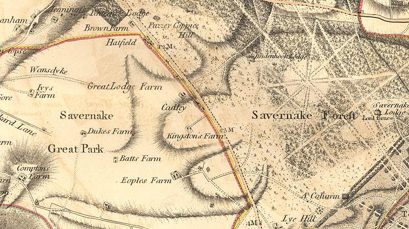
Savernake Parish in 1810
Very few trees were planted in Savernake between 1814 and 1945; and
indeed after about 1870, when most of the forest was fenced and turned into an
enormous deer-park, it was not practicable to plant trees without expensive
guards to protect young saplings from the browsing deer. Another result of
creating this park was a need to gate the roads, including the present A4 and
A346, which passed through it. The gates remained in use until the 1920s, and a
gatehouse survives at the foot of Postern Hill, where the A346 begins its climb
into the forest.
Since the second world war Savernake Forest has been the responsibility of the
Forestry Commission, whose sympathetic management has retained the character of
the eighteenth-century creation while carrying out extensive replanting, and
encouraging public access, notably by providing a commodious camping and picnic
site at the top of Postern Hill. From here expeditions may be made, not only to
enjoy the legacies of the eighteenth and twentieth centuries, but also to
discover the gnarled giants of the forest, ancient oaks of immense girths and
romantic names the Cathedral Oak, the King of Limbs, the Amity Oak. The least
shy of these dryads also has the most blatant name, the Big Belly Oak. Nearly
11m around its trunk, and perhaps a millennium old, it protrudes its belly into
the main road just south of Cadley.
Thus we have traced in outline the historical evolution of Savernake, and it
remains to describe particular features of note. A natural constraint the
relatively poor soils of the clay-with-flints deposits overlying the chalk and
the legal constraint of medieval forest jurisdiction, have perhaps combined to
assist the preservation of archaeological sites in the area of the modern
parish. On the hillside overlooking Marlborough near Pantawick and Brown's Farm
have been discovered a neolithic flint-working area, bronze age artefacts, and
possible iron age and Romano-British settlement sites. Flint working seems also
to have taken place on Granham Hill and Wernham Hill. A late iron age coin
hoard was found in 1857 near Brown's Farm, and in 1890 a fourth-century hoard
of Roman coins was discovered in an earthenware pot on Granham Hill. 'Savernake
Ware' has become a familiar term to archaeologists, denoting a type of
light-coloured coarse Roman pottery, which is found chiefly on sites from
first- to third-century date within the presumed catchment area of the market
at Cunetio, the Roman town at Mildenhall. The vicar of Savernake correctly
identified in 1921 what is believed to be the main production centre, near
Bitham Pond on the Column Ride north of Leigh Hill, when he described
"intensely black earth over an area of nearly three acres", and a tradition
that Roman kilns had existed there. Between 1957 and 1961 excavations on the
site proved the truth of this tradition by uncovering kilns there, and others
have been found elsewhere in the forest.
Undoubtedly the industry was located in this area not only because of the local
availability of suitable clay and wood for firing, but also because the Roman
road network radiating on Cunetio made its distribution reasonably economical
and breakage-free. Two Roman roads cross the parish, leading from Cunetio to
Winchester and Old Sarum. The former ran slightly east of the Grand Avenue, and
traces survive in many places along its route; the latter is more elusive. It
was identified by Colt Hoare in 1821 as running almost directly south from
Cunetio towards Brimslade and Easton Royal, and although it is scarcely visible
today, a short alignment survives in the clearing at Braydon. Wansdyke crosses
the parkland area of the parish west of the present main road, and is extant
near Wernham Farm and New Buildings. A small excavation carried out in 1967
near New Buildings demonstrated that this, the eastern portion of Wansdyke, was
less substantially built, and perhaps slightly later, than the main defence
further west.
The present main road through the parish (A346) had become important by the
thirteenth century, when it is mentioned in perambulations, and was used in the
sixteenth century, as we have seen, to divide the parkland from the unpaled
forest. Medieval roads, when they had to tackle steep hills, often divided into
a series of parallel hollows known as multiple trackways, and one of the best
examples of this phenomenon survives on Postern Hill, the main road's ascent
from Marlborough. The tracks fan up the hill from the lodge at its foot; most
are now scrub-covered in long grass, but are quite visible and accessible, and
climbing them it is not hard to imagine the stamina required of pre-motorised
man and beast. The main road was turnpiked in 1762, and the present route up
the hill was in use by 1773.
At Brimslade Farm, which is statelier than the other Savernake farmhouses, and
contains work dating back to its parkland days in the sixteenth and seventeenth
centuries, the peaceful isolation was disturbed by the opening of the Kennet
and Avon Canal in 1809. Here the summit level, which has brought the canal
through the forest, ends in a flight of four locks, restored and reopened in
1973, which step it down to Wootton Rivers and Pewsey Vale. A little to the
south the Berks and Hants Extension Railway, opened in 1862, adopted a parallel
course, and remains in use as part of the London-Exeter main line.

Savernake Parish in the 1890s
The complicated business of providing Marlborough with a railway has
left substantial traces, from Hat Gate near Brimslade, across the former Great
Park, to stations below Postern Hill. There are two lines, the earlier, of
1864, sweeping past Culleys Farm and Wernham Farm, the later, of 1898, taking a
more easterly course past Park Farm, which involved building deep cuttings and
a tunnel near Pantawick some 600m long. Near Hat Gate a wartime branch and
sidings served massive ammunition dumps hidden in the forest, which are
believed to have employed some 10,000 troops. In July 1945 and January 1946
massive explosions occurred here. The former badly damaged nearby St
Katharine’s church, the latter (involving salvaged German ammunition) killed
eight soldiers, including one who had served throughout the war and was due to
leave the army the following day. The two Marlborough branch railways were operated
by rival companies until 1923, and it was not unknown for races to take place
between Marlborough and Savernake stations. The tunnel was a favourite resort
for clandestine smoking bouts by Marlborough College boys. By 1933 the earlier
of the two branches had been removed, but the 1898 line continued in use until
1961 for passengers and 1964 for goods.
There is no village or important settlement within the modern parish. The
centre of medieval forest administration was at Morleigh, which is now Leigh Hill,
and the ranger of the unpaled forest had his headquarters at Bagdon Lodge,
which was subsequently renamed Savernake Lodge. This house was rebuilt in 1795
by Sir John Soane and burnt down in 1861. The present Savernake Lodge was
created in 1910 from the surviving stable block. The imprint of the Ailesbury's
taste in buildings may be seen scattered about the forest. Most are of brick
and tile, for there was abundant clay for brickmaking on the estate, and many
have as decoration bands or designs of gaudily-polychromatic brickwork. There
is a spectacular example of 1854 at Cadley. Other interesting buildings are the
Savernake Hospital of 1872, which replaced a stopgap building on Forest Hill
given by the Ailesbury family in 1866 to provide a cottage hospital (apparently
the third oldest such foundation in England) for the local poor. At Cadley, the
largest of the forest hamlets, which is strung out along the fast main road,
the marquess built a parish church in 1851 and a National school in 1850. Both
have now closed the school in 1939, the church in 1975. Christ Church,
Cadley, was designed by T H Wyatt, and the present building, now a house, was
his second attempt, as the 1851 building fell down in 1852 and had to be
rebuilt. Pevsner describes as 'naughty' its curious arrangement of windows
facing the road. The churchyard remains accessible, and here are buried members
of the Byron family of Savernake Lodge. Robert Byron, drowned at sea in 1941,
was a talented writer on architecture and eastern culture, and the editor of
the first Shell Guide to Wiltshire.
This Savernake Parish History by John Chandler is taken from his two books ‘Marlborough and Eastern Wiltshire’ (Hobnob Press, 2001, 20.00, ISBN 0 946418 07 1) and ‘Devizes and Central Wiltshire’ (Hobnob Press, 2003, £20.00, ISBN 0 946418 16 0). The text included here is the author's copyright and should not be further reproduced for publication without his consent. There may be minor textual variants between the text posted here and the published version.
Dr Chandler will be happy to supply hardback copies of either ‘Marlborough and Eastern Wiltshire’, which includes histories of 34 parishes in eastern Wiltshire (from Tidworth in the south to Aldbourne in the north and Avebury in the west), with illustrations and maps, or the publication ‘Devizes and Central Wiltshire’, which includes histories of 42 parishes in central Wiltshire, with illustrations and maps, for £20 each post free. He can be contacted by email: jh.chandler@hotmail.com ; or by post: 8 Lock Warehouse, Severn Road, Gloucester GL1 2GA.
A fuller account of Savernake Parish can be found in the publication: ‘Victoria County History of Wiltshire’, vol. 16 (1999), pp.207-15. This is to be found in larger local libraries and the text is available online at http://www.british-history.ac.uk/report.aspx?compid=23049 alongside accounts of neighbouring parishes.